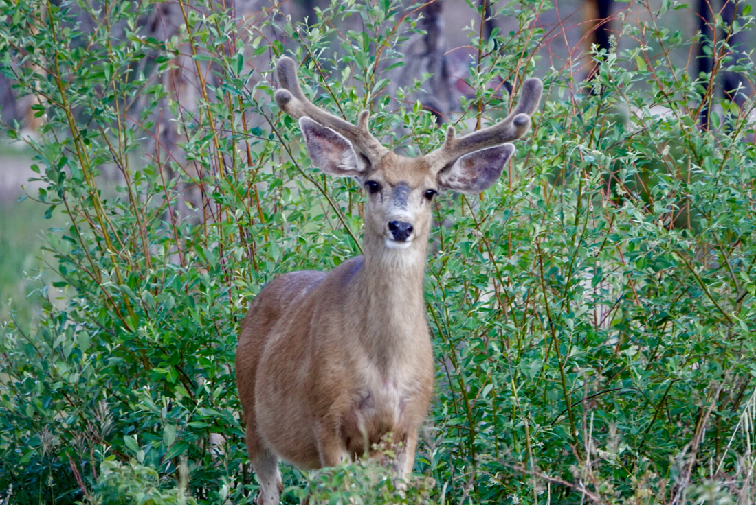
We stood in awe before the biggest tree in the world, a giant Sequoia. We couldn't touch it, hold it, or breathe in its life. Named General Sherman, this massive tree is cordoned off from the crowds of adults and children that pay pilgrimage to Sequoia National Park in California. While not the oldest or tallest tree in the world - it's the biggest by volume in its trunk. It's tree top is dead so it's trunk doesn't get taller, but the tree’s volume increases as it gets wider. General Sherman’s girth is 109 feet around at the ground, and it weighs 1385 tons - that's 2,770,000 pounds! If the trunk could be filled with water, it could provide 9,844 baths; or one bath every day for 27 years! Needless to say, it is very impressive and just one of many majestic Sequoias here. Just up the road, still in the park, towers the General Grant tree, the world's third largest tree. It is the widest known living tree at 40 feet in diameter but by volume is 46,608 cubic feet (Sherman is 52,500 cubic feet). At 1700 years old, it's about 500 years younger than General Sherman but hugely impressive in its own right. | 
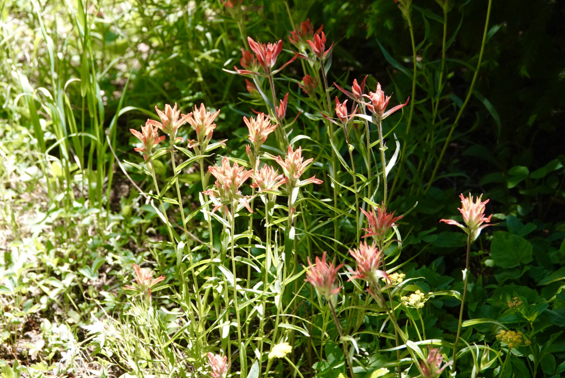
If you could fill its trunk with basketballs, it would hold 159,000 or 37 million ping pong balls!! At the base of the trunk, 20 people holding hands can encircle the tree. Both General Sherman and General Grant are awe-inspiring trees, and they stand in groves of other Giant Sequoias that tower above people, plants and animals, growing only in a few places on Earth. Thankfully the largest grove of Sequoias in the world is protected in Sequoia National park which is adjacent to Kings Canyon National Park where we spent Labor Day weekend. These parks are gorgeous with their towering trees and massive canyons, raging river, streams and meadows of wildflowers. Surrounded by national forests with aspen groves and clear blue lakes, there are lots of places to camp, fish, boat and hike. When we stayed, smoke from fires in CA drifted in and filtered the sunlight, casting a gray filter over the glorious canyons. It was very, very hot also, but we enjoyed hiking and sightseeing early in the day |
When we left the parks, we drove east towards Colorado, stopping at Alabama Hills for a night. This is a beautiful desert area on the eastern flank of the Sierra Nevada mountains that has provided a backdrop for countless movie scenes, including some from IRONMAN, GLADIATOR, HOW THE WEST WAS WON, DJANGO UNCHAINED, STAR TREK GENERATIONS, and many more. The day we left, we stumbled upon a twisting turning road that led to a national forest that was worth a stop of a few hours. The Bristlecone Pine National forest preserves these interestingly twisted and colorful trees which are much smaller than the majestic Sequoias. BUT here reside the oldest living organisms in the world! There is a newly built visitor center and a 4- mile loop trail (on which dogs are allowed) that leads to a grove containing the oldest tree on earth. Methuselah, the aptly named tree, is over 5,000 years old. The forest service won't label the tree or point it out, but they tell you when you're in the grove containing this tree. It's a moving experience to stand and touch these trees that have been sculpted by wind and rain into angled and twisted trees… trees that existed when Moses walked the earth. Some of them may appear dead at first glance because of the blonde, black and brown trunks, but upon close examination you can find offshoots with green needles and cones sticking out; they are very much alive. Sculpted by thousands of years of barren soil, drought, and wind-whipped sand and ice, the world's oldest trees survive where few other plants put down roots. Great Basin Bristlecone pines grow only in cold, dry, windswept locations high in the mountains of Utah and Nevada, and eastern California. They attain great age, not in spite of their harsh environment, but because of it! We visited these places in CA before heading across the country to see first Sundance in CO and then friends in VT with a goal of reaching Nova Scotia, 3000 miles away by October 1. Before reaching Sundance we stopped at Colorado National monument to drive the rim road for a couple of hours and soak in the beauty of the sandstone canyons. We spent a weekend with Sundance enjoying time on his land and with his cats and friends; then we took 10 days to reach VT. Along the way, we had memorable stops as we camped at Rolling Hills West Lake and watched a feeding frenzy of Monarch butterflies on milkweed, followed by a fabulous sunset over the lake. One day in Illinois we just had to stop and see what the signs along the highway proclaimed was the largest golf tee, rocking chair and wind chime in the world! Turns out, Casey, IL has at least 8 of the world's largest items: pencil, golf tee, rocking chair, wooden shoes, pitchfork, crochet hook, knitting needles, mailbox, and possibly also bird cage. It's a beautifully landscaped little town with quaint cafes, candy and gift shops….worth the hour detour to see a few more superlatives. In Ohio near the heroin overdose capital of the U.S. (Dayton, OH where interstates abound making drug trafficking easy), we stopped for a Bluegrass festival in Miamsburg and enjoyed some national and regional acts on a beautiful sunny afternoon. We discovered there's a rich history of bluegrass here which started in the early 1900’s. For 7 decades, millions of folks from Appalachia poured into the Midwest cities to work in factories and farms fleeing economic decline in KY, WV, and TN - traveling up the Dixie Highway (US 25), US 23 or US 52 and over the Ohio River. Beginning in 1947, local radio station WPFB helped launch the careers of some of the best known bluegrass musicians including the Osborne Brothers, Jimmy Martin, Red Allen, JD Crowe as well as many others. In nearby Cincinnati, Flatt & Scruggs were recording “Foggy Mountain Breakdown” and scores of bars and nightclubs catered to bluegrass enthusiasts as the King record label expanded their reach with bluegrass artists. We took Rocket to the free all day concert and enjoyed Larry Sparks, Clay Hess Band, Branded Bluegrass and Surly Gentleman along with others. (I might add the local brews are pretty good too!) Another noteworthy stop was the campground at Crown Point, NY just west of the Champlain Bridge leading into VT. Remnants still stand of Fort St. Frederic built in 1731 by the French to serve as an outpost during King George’s War. Within the campground (state park) is a monument to Samuel Champlain, intrepid navigator, explorer and pioneer for whom Lake Champlain is named. We've passed this place hundreds of times on our way to D.C. or back to VT when we lived in Huntington. But since it's only about an hour away, we never stopped when we had 500 miles to go. We were happy to spend five days in Huntington, VT. Our old neighborhood let us park our RV in the meadow of the neighborhood which meant we could easily visit with friends, take hikes on the common land, and enjoy the view of Camels Hump Mt. Our friend Vicki Hughes even came for a night, bringing her young pup Gudrun. We went swimming at Bristol Falls, hiked Mad River with friend Lisa Burt, had a bonfire, and visited the Hodge family during a Giants game telecast. We had dinner with the Richters and hiked with a group of ladies who have sons Sundance's age - we met years ago on the baseball field. I even did an escape room in Burlington with eight others. We actually escaped with 3:45 to spare of the allotted hour. This was a very fun evening made more special because the first Escape room I did in Burlington back in January, we were unable to escape from. If you aren't sure what I'm talking about, Google Escape rooms. It's a game that’s really fun and in a lot of cities these days. We've left VT and are in Maine now enjoying an Indian Summer. Stay tuned for more about Acadia National Park and Nova Scotia in my next blog!
0 Comments
Today I thought I'd take you on a ride with us on one of our travel days. It's 6:30am and quiet in the campground when we awaken. It's Friday morning of Labor Day Weekend, and our plan is to drive from Yosemite National Park to Kings Canyon National Park, CA. After a dog walk and some cereal, we head to the dump station and plan to hook up the tow vehicle (our 2007 manual transmission Subaru). It's now just before 7am, and in the grassy area across from the dump station is a doe white tail deer grazing without giving us a second thought. We've seen quite a few deer in Yosemite and tons of squirrels….still looking for the black bear who frequently shows up in the campgrounds. As we head out of the valley traveling 35 mph we smell and see the smoke layer lying low. It's worse than yesterday and is a result of 3 fires burning in the park - 2 started naturally, lightening strikes. The third was man-made, starting when a tree company felled a tree on electrical lines. The closest fire to the valley where we've been staying is in the southern part of the park and the road out near the Mariposa area of Sequoias is closed. So we exit on the western side - via Rt. 140. It's a longer way out but can't be helped. The meadow views in front of El Capitan are not well lit…besides being early, the haze is a factor. Good thing we got some photos yesterday before the smoke thickened. Most of the tourists are still snug in their beds and sleeping bags, so it's a nice time to travel. Once out of the park the road follows circuitously by the Merced River which is fast churning for this time of year - likely a result of the deep snow pack last Winter, still melting atop the high Sierra peaks. My eyes are glued to the hillsides along the river banks. They are covered in tall brown grass with the occasional scrub bush…but not too tall you can't see a mountain lion patrolling. Unfortunately, we see no lions and no bears. But for 38 miles we follow the twisting, churning river on a beautiful trail. At one point, travel is one lane only as the road is closed due to a rock slide which completely obliterated it. Engineers have built a bridge across the river and another lane on the opposite side because there is no room, or likely desire, to replace the road on the south side of the river. As we meander down the river I notice the depth changes and so do the striation patterns in the rocks. Fisherman cast from both the banks or hip deep in the water, and the light is interesting, casting an orange tint on things due to the smoke-filtered sun rays. There's a steady stream of cars coming towards Yosemite, and I notice lots of ravens in family groups of 2-3. We pass a historical marker for a stone bridge built in 1926 but drive past. I have the iPad shuffling through a Grateful Dead cd and interestingly enough, the song FIRE ON THE MOUNTAIN is playing as we cross Bear Creek and the hostel nearby. Terry does all the RV driving which frees me up to navigate and sight-see. When we bought the coach (2014 Fleetwood Terra, 31’), one important reason we chose a motorhome instead of a 5th wheel pull-behind was to view the roadways from the large front windshield. We travel so many scenic highways and arrive and depart so many national parks in it, that we wanted that IMAX feeling view. Sitting higher than cars, looking over guardrails and into streams and valleys, it's a perk of hours in a vehicle to have the comfort and vantage point the massive windshield affords. As the road leaves Merced River and climbs uphill, I notice Ponderosa Pines looming above the now taller golden grass with game trails scattered throughout. Along this road there are quite a few turn-outs which we use. In California, as with other states, law requires drivers to pull over if 5 or more cars are held up behind you. As you can imagine with our RV and car in tow, particularly going uphill, we are slower than most vehicles so we pull over and let folks pass regularly. At 8:45am we are past the town of Mariposa when we see fire destruction. Hillsides along the roadway are scorched, and trees still standing are blackened and brown. The fire leapt the road as lawns and fields on both sides are scorched. I wonder if this was caused by a thrown cigarette butt. Brown leaves and needles still hang from the trees, and there's a white powdery substance on the ground…must be fire retardant chemicals. A few houses or structures didn't make it, but mostly homes were saved. Hand painted signs on fence lines thank firefighters for their efforts. Once we reach Cathays Valley, the fire scorched earth is only on the left side of the road, and after ten minutes of this landscape, rolling golden grasslands with grazing cattle unfold from the Last Chance Ranch. For the next 15 minutes we enjoy beautiful pastures watched over by hawks on electric poles. There's still smoke in the air, and the sky is a dull gray. Soon the road turns south and we come to vast agricultural fields with trees laden with fruit and nuts. I believe we're passing almond and walnut trees, as well as corn fields and grape vines. We pass a women's prison at one point and soon take CA-99 south for 28 miles. We have to get gas, and filling up can take us 10-15 minutes. Our tank holds 80 gallons and with gas prices ranging between $2.55-4.99 in CA we choose carefully, often using Mapquest’s Gas price app. Sometimes the right choice can save us $5-40 per fill-up. Since we don't often stay in one place for weeks or months, our gas bills can run $500-750/month for just RV gas. This fill up costs us $132.00, and we push on. On highway 99 we pass more nut groves, orange groves and grapes. There are small towns and railway tracks and at one point we see fire trucks on the other side of the highway with burned grass alongside. A small and contained fire, probably another cigarette butt (or vehicle fire) I'm guessing because of proximity to the road. We cross the San Joaquin River, and the median strip launches a profusion of pink and white emanating from flowering bushes. There are a few palm trees dotting the landscape too. At 10:20 we head east on CA 180, and the median here holds only dirt and trash. Then it gives way to a two-lane winding road that passes orange groves, hills and grasslands. At 11:15am we stop at the Hume Lake District Ranger station. We want to ask about dispersed campsites in the national forest surrounding Kings Canyon National Park. The ranger informs us that the roads there won't be suitable for the RV even though there are sites in the forest. She calls to the park and discovers there are sites at the park’s Moraine Campground. It's about an hour and 15 minutes from her office and near the end of the park road. Other campers are in the office, and we decide to hurry before the sites are filled. After all, it's the Friday before Labor Day! Typically if we think an area will be booked, we try to arrive Thursday or at least Friday before 11am to secure a weekend site. We often go to campgrounds that are not 100% reservable and have some first come, first served. In this case, when we left Yosemite we figured we'd get a dispersed site (forest service has these free campsites with no services, but they are often some of the best spots and not in crowded campgrounds). But now we discover we are jockeying for a paid site during a busy time. Kings Canyon National Park is situated right next to Sequoia National Park with National forests intermingling around and between the two parks. There are also several wilderness areas around the parks and forests. It's an interesting area with lots to see and do, and while there's still smoke in the air, it’s not as bad here as in Yosemite. Of course that can change with the wind. The road is a winding climb through hills in the Giant Sequoia National Monument which lies just outside the national park. It's slow going for the rig, and we have to use turn-outs - hoping the vehicles we let past don't grab the last campsite! Our speed is 32-40mph while other cars are driving 50 mph. At the ranger district office we read the weather report. Each day of the weekend there is potential smoke haze, but between the district office and our destination a 20° temperature difference is expected. A heat advisory is in effect today with 106° expected in town, while our destination is expected to be only 85°. The elevation will soon be our friend. At the park entrance there is a line of cars: two lanes with each having about 9 cars in front of us. Anxiously we choose our lane and hope the people in front of us don't need change or have an annual pass like ours, which will speed things along. We make it through ahead of the guy we were behind in the opposite lane…the guy who gave us the finger when he cut us off earlier on the road! Once in the park though, the drive into the canyon is stunning! I really didn't know what to expect as I hadn't done any research on this park. I knew it was beside the Sequoia park and we'd see giant Sequoias, but I had no idea the rugged canyon would provide such a spectacular backdrop for our journey. The photos I take can't do it justice, not only because of the vastness but because of the haze in the sky. About 5 miles from our destination, we come to a complete stop at what looks like road construction. Only one lane is open and the Canyon below the guardrail ahead drops over a thousand feet down. We turn off the RV to wait and each get a snack from the fridge (another perk of traveling in a motorhome as opposed to a 5th wheel - everything is at our fingertips). We wait for over 30 minutes wondering what the hold up is and worrying whether the campsite will be available once we arrive. But then again, everyone else is waiting in this line too. It's 1pm when we finally get through the stoppage. While the signs and cones are construction related, the scene we reach is something entirely different. There is no construction. What we see are over 50 vehicles to one side…fire, Sheriff SUV’s, Park Ranger cars, a helicopter, there are men and women in search and rescue clothing, someone with a drone….its a spectacle like we've never seen. All of this happening 1,000’ above the canyon floor with a fast raging river flowing through. We learn that 5 weeks earlier a car drove off the side, and the passengers have been trapped inside their watery grave all this time, unreachable until the water level lowered. Their bodies are to be retrieved today. It’s a sobering start to our visit in the canyon. We see the angry churning river closely the next few miles to Moraine Campground. It's a beautiful, if violent, river; and, there are signs near entry points that warn of the swift currents and unpredictability of the water. When we arrive at the campground (2 hours rather than the anticipated 1.25 from ranger station), there is a truck in front of us also searching for a campsite. We pass one empty site that we MIGHT want (73), and so I jump out to occupy it before the truck comes back to grab it. Minutes later, Terry parks the RV in other site (14) and bikes to me tell me to let #73 go. (The truck passed by me as I waited.). But we still have one loop to check, and Terry thinks he can't get the RV level in site 14. So I drive the last loop and discover another site (51) I think more suitable. I leave the car, and run up to him to suggest #51 so he moves the RV only to discover we can't level there either! At this point, both of the other sites we tried (14 & 73) are taken, and we are getting anxious. Things are filling up fast. We have 2 more options, and luckily #61, the next one we try, is level with a large area to spread out as well. Within a few minutes, the empty site beside us (62) is occupied, and the campground is full by 2pm. It's been a long day of travel, but oh so interesting. Now it's time to drive to Road’s End, to take a short hike along the river and find a calm place for Rocket to cool off. It's been interesting, but just another travel day on the road with the Stadtlers….
|
AuthorFormer documentary film producer, wife and mother of one...I'm taking time off to see the US with my husband Terry. Here's where I'll write about our adventures RVing until the money runs out! Archives
August 2021
|